Engineering Research
Wind Design Mapping For Use in the City and County of Honolulu
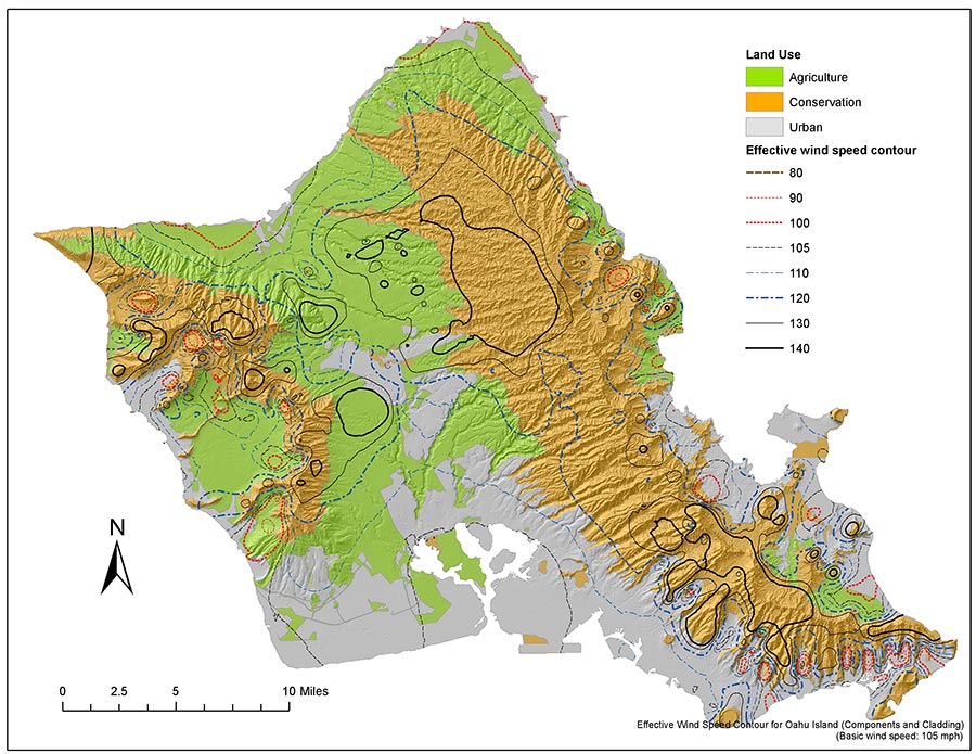
This project entailed the preparation of a comprehensive wind study for adoption of the City and County of Honolulu Building Code with local amendments to the International Building Code (IBC) provisions and ASCE 7 incorprating design windspeed mapping. As the successor to the Uniform Building Code, the IBC introduced an ASCE-7 topographic factor, Kzt, which in its generic specification does not give accurate results nor can it be applied with consistency in the complex topography of Hawaii.
The ASCE-7 standard also requires a directionality factor, Kd. It had been based on flat terrain conditions; implementation of the ASCE wind standard in Hawaii required a GIS-based probabilisitic evaluation of the Kzt and Kd wind directionality terms. The Project involved detailed spatial analysis of experimental wind data to develop GIS mapping of wind design parameters. Consistent with the requirements of the International Building Code and intent of the ASCE-7 standard, customized wind design factors were developed from site-specific wind-tunnel test data for the topographic effects factor Kzt, the directionality weighting factor, Kd, in consideration of the probability of critical windspeed, and mapping of Exposure Categories for determination of Kz , exposure coefficient, based on land cover remote sensing data. This work also included the drafting of the Honolulu Building Code Structural Wind Provision amendments for the City’s code adoption ordinance. Maps have recently been updated for inclusion in the ASCE7-16 standard.
WORK WITH US
CALL (808) 521-4513
1001 Bishop Street,
Suite 2950, Honolulu,
HI 96813